


Description
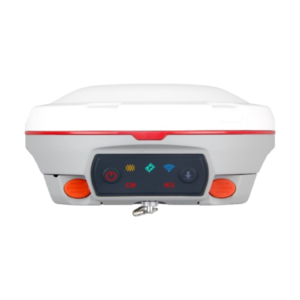
Geodetik Topcon HiPer VR
Geodetik Topcon HiPer VR Better things in smaller packages!
- The HiPer VR* is compact, light and packed with the most advanced GNSS technology in a design built to withstand the harshest field environments. Using Topcon’s advanced GNSS chipset with Universal Tracking Channels Tecnology, the HiPer VR automatically tracks every satellite signal above – now and into the future.
- All signals, all satellites and all constellations — in a compact, rugged design, with an integrated IMU and eCompass.
GPS Topcon HiPer VR
Geodetik Topcon
- The HiPer VR is a complete solution and versatile in many ways. It can be used for static or kinematic GNSS post-processed surveys, as a network RTK rover with the FC-5000’s internal 4G/LTE cellular modem, as a UHF/FH/Longlink jobsite RTK rover, and also in Topcon’s patented Hybrid Positioning workflow.
Fitur
- Universal tracking technology for all satellites and constellations (GPS, GLONASS, Galileo, Beidou, IRNSS, QZSS, SBAS) covering all modernized signals
- Field tested, field ready IP67 design
- Compact form factor ideal for Millimeter GPS and Hybrid Positioning
- Revolutionary 9-axis IMU and ultra-compact 3-axis eCompass
- Integrated 400 MHz UHF Tx/Rx Radio Modem
- Integrated License free 900 MHz Radio Modem, FH915 protocol
- Topcon HiPer VR Inertial Leveling Technology (T.I.L.T.) By combining a 9-axis inertial measurement unit (IMU), along with a digital compass, the HR can accurately compensate for up to 15º of tilt on the rod. Now you can measure all the way to a building edge without using an offset. Or stretch to get an otherwise out-of-reach point. Just as with many other Topcon technologies, T.I.L.T. is designed to solve real-world challenges, so your work gets easier, faster, and better.
Spesifikasi
- PELACAKAN GPS
Jumlah Saluran : 226 dengan teknologi Universal Tracking Channels ™ yang dipatenkan Topcon
Sinyal Dilacak
Sinyal GPS: L1 C / A, L1C * L2C, L2P (Y), L5 **
GLONASS: L1 C / A, L1P, L2C / A, L2P, L3C *
Galileo: E1 / E5a / E5b / Alt-BOC BeiDou / BDS: B1, B2
IRNSS: L5 *** SBAS: WAAS, EGNOS, MSAS, GAGAN (L1 / L5§)
L-band: TopNET Global D & C Koreksi layanan
QZSS: L1 C / A, L1C, L1-SAIF, L2C, L5
* L1C saat sinyal tersedia.
** L3C saat sinyal tersedia.
*** L5 saat sinyal tersedia.
- AKURASI
– Statis Cepat (L1 + L2) H: 3 mm + 0,4 ppm V: 5 mm + 0,5 ppm
– RTK (L1 + L2) H: 5 mm + 0,5 ppm V: 10 mm + 0,8 ppm
– Sensor Kemiringan Kompensator * * Sudut maksimum yang disarankan untuk kompensasi kemiringan adalah 15 ° H: 1,3 mm / ° Kemiringan; Kemiringan ≤ 10 ° V: 1,8 mm / ° Kemiringan; Miringkan> 10 °
– DGPS 0,25 m HRMS
- TENAGA dan KELISTRIKAN
– Waktu Operasi Mode RX – 10 jam mode TX 1W – 6 jam
- UMUM
– Radio 425-470 MHz radio UHF Max Transmit Power: 1W Jangkauan: 5-7 km tipikal; 15 km
– Memori Internal SDHC 8 GB Non-removable
- FISIK dan LINGKUNGAN
– Perlindungan Ingress IP67
– Pengoperasian Temperatur -40ºC sampai 65ºC
– Kelembaban 100%, kondensasi
– Drop Test 1,0 m jatuh ke beton. Tiang 2,0 m jatuh ke beton.
– Dimensi 150 x 100 x 150 mm (w x h x d)
– Berat <1,15 kg
“KEPERCAYAAN ANDA ADALAH MODAL UTAMA KAMI”
Beli Geodetic RTK GNSS Receiver dengan harga ekonomis, Gratis biaya pengiriman wilayah Jakarta dan dapat dikirim keseluruh Indonesia. Dapatkan hanya di FAMILIAS SURVEY toko online terbaik Seluruh Indonesia, belanja online mudah aman dan terpercaya.
Reviews
There are no reviews yet.