



Description
GPS Geodetik SinoGNSS N2
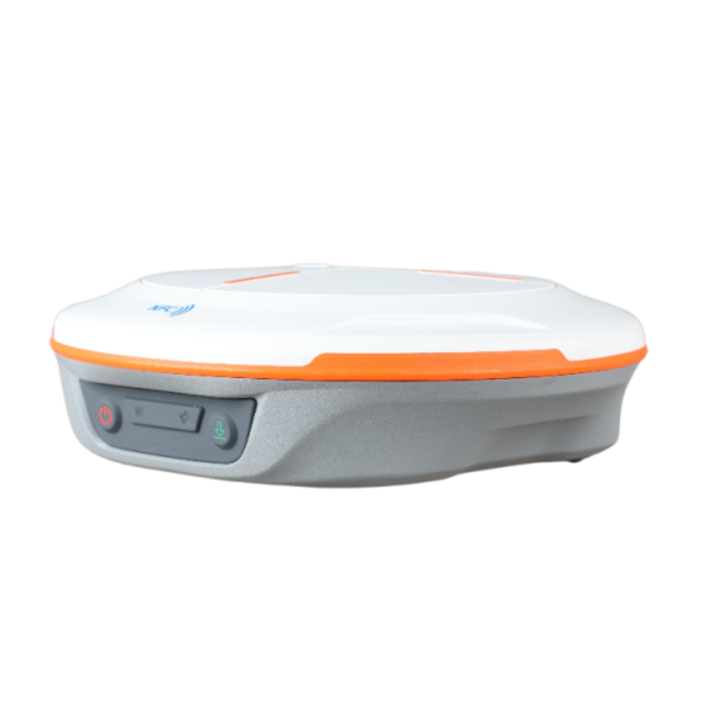
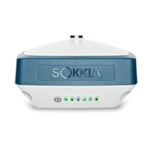
GPS Geodetik SinoGNSS N2 Slim-line design makes the N2 one of the most compact GNSS receiver: only 48mm and 0.67kg including battery. Compared with a typical GNSS receiver, it is more than 35% thinner and 40% lighter, can be carried, used and operated more easily without fatigue. Lighter, Thinner, and Stronger – N2 is specifically designed for land survey, marine, precision agriculture, machine control, and GIS.
Jual GPS Geodetik SinoGNSS N2
Jual GPS Geodetik SinoGNSS N2
- Easy Connection
With advanced NFC, N2 can be connected automatically with a single touch. Dual mode Bluetooth 5.0 allows users to connect at higher distance and low energy standards. Tedious matching is a thing of the past - 3rd Generation IMU
By compensating for up to 120° tilt, N2 eliminates challenges associated with surveying concealed or unsafe points and maintains accuracy within 2.5cm. Also, being immune to magnetic disturbance increase reliability - Enhanced UHF
Integrated UHF ranges from 410 to 470 MHz. Up to 15km long work range makes it work-efficient and energy-saving for field work. It can be used as either a base station or a rover in largely extended working scenarios - Longer Battery Life
10000mAh Battery makes 20+ hours day&night work possible. QC2.0 helps N2 full-charged in 5 hours, dealing with the worry about power outage
Fitur :
-
1590 channels and 50+ satellites tracking capabilities
-
Tracking all running and planned constellations, including GPS, BDS-2, BDS-3, GLONASS, Galileo, QZSS, IRNSS and SBAS
-
Up to 15km work range with enhanced UHF
-
Up to 120° tilt with 2.5 cm accuracy
-
20+ hrs continuous work with 10000mAh batteries
-
Support NFC and Bluetooth connection
-
IP67 dust- and waterproof for harsh environments
Spesifikasi
- Channel: 1590
- Satellites tracking
GPS : L1C/A, L1C, L2P, L2C, L5
BDS : B1I, B2I, B3I, B1C, B2a, B2b
GLONASS : G1, G2, G3
Galileo : E1, E5a, E5b, E6c, E5 AltBOC
QZSS : L1C/A, L2C, L5,L1C
IRNSS : L5
SBAS : L1C/A - Signal Re-acquisition : ≤1s
- Cold Start : ≤45s
- Hot start : ≤15 s
- RTK Initialization Time : <10s
- Initialization reliability : ≥99%
- Internal Memory1 : 8GB
- Single Baseline RTK : Horizontal 8mm + 1ppm RMS Vertical 15mm + 1ppm RMS
- Static and Fast Static : Horizontal 2.5 mm + 0.5 ppm RMS Vertical 5 mm + 0.5 ppm RMS
- Long Observation Static : 3 mm + 0.1 ppm Horizontal 3.5 mm + 0.4 ppm Vertical
- DGPS : <0.4m RMS
- SBAS :0.5m Horizontal 0.8m Vertical
- Standalone : 1.5m 3D RMS
- Data Update Rate : 1Hz, 2Hz, 5Hz, 10Hz
- Tilt Survey : up to 120° tilt with 2.5cm accuracy
ITEM PEMBELIAN :
Base N2
Rover N2
Controller R550
Radio Eksternal CDL7
Tripod
Tribrach
Pole Carbon
Garansi 12 Bulan
Reviews
There are no reviews yet.